Understanding Special Marine Warnings: Protecting Lives and Vessels at Sea
Navigating the world’s oceans, lakes, and rivers offers unparalleled opportunities for recreation, commerce, and exploration. However, these vast bodies of water can also present significant dangers. Among the tools used to mitigate these risks, special marine warnings stand out as critical alerts designed to protect lives and property. This comprehensive guide delves into the intricacies of special marine warnings, explaining their purpose, interpretation, and importance for anyone venturing onto the water.
What is a Special Marine Warning? A Deep Dive
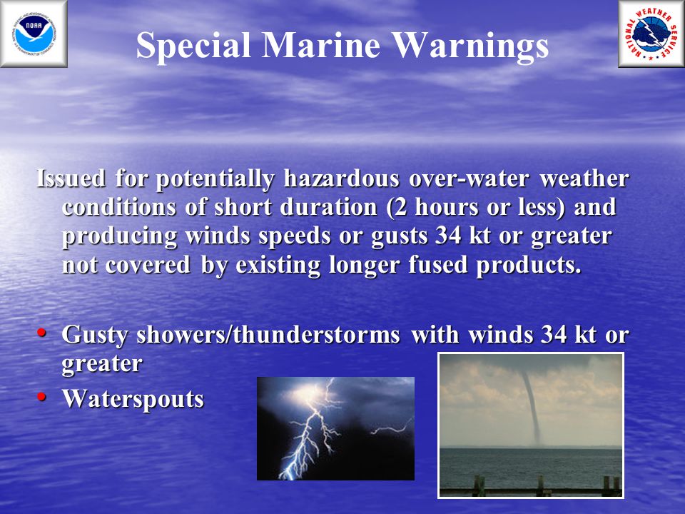
A special marine warning (SMW) is a weather forecast product issued by national weather services to alert mariners to imminent or occurring hazardous weather conditions posing a significant threat to navigation and safety. Unlike routine forecasts that cover broader periods and areas, SMWs are short-fused, highly specific, and demand immediate attention. They are essentially the marine equivalent of a severe thunderstorm or tornado warning on land.
These warnings typically cover relatively small geographic areas and are issued for conditions expected to last for a limited time, usually no more than a few hours. The conditions that trigger an SMW can vary depending on the specific region and the capabilities of the issuing weather service, but common triggers include:
- Severe thunderstorms: Capable of producing high winds, large hail, and dangerous lightning.
- Squalls: Sudden, localized increases in wind speed, often associated with thunderstorms or frontal passages.
- Waterspouts: Tornadoes that form over water.
- High winds: Sustained winds or frequent gusts exceeding a specific threshold (e.g., 34 knots or 39 mph, often considered gale force).
- Hazardous sea conditions: Steep, dangerous waves, or rapidly changing wave heights.
- Visibility restrictions: Fog, heavy rain, or other conditions that significantly reduce visibility.
Special Marine Warnings are not a one-size-fits-all product. Their specific criteria and terminology can vary between different weather forecast offices and regions. For example, the National Weather Service (NWS) in the United States has different zones and thresholds for issuing SMWs depending on the coastal or inland waters being covered. Understanding these regional variations is crucial for mariners operating in different areas.
The issuance of a Special Marine Warning is a critical decision, requiring forecasters to weigh several factors, including observed weather conditions, radar data, satellite imagery, and forecast models. The goal is to provide timely and accurate warnings that allow mariners to take appropriate action to protect themselves and their vessels. Failing to heed these warnings can have severe consequences, including capsizing, grounding, or even loss of life.
The Role of the National Weather Service in Special Marine Warnings
The National Weather Service (NWS), a branch of the National Oceanic and Atmospheric Administration (NOAA), plays a central role in issuing special marine warnings in the United States. The NWS has a network of weather forecast offices (WFOs) located across the country, each responsible for monitoring weather conditions and issuing forecasts and warnings for its specific geographic area. These WFOs employ trained meteorologists who use a variety of tools and technologies to detect and predict hazardous weather conditions.
The process of issuing an SMW typically involves the following steps:
- Detection: Forecasters monitor weather conditions using radar, satellite imagery, surface observations, and other data sources. They look for signs of developing hazardous weather, such as strong thunderstorms, squalls, or high winds.
- Analysis: Once a potential threat is identified, forecasters analyze the available data to determine the severity and extent of the hazard. They use forecast models to predict how the weather will evolve over time.
- Decision: Based on their analysis, forecasters decide whether to issue a special marine warning. This decision is based on specific criteria, such as wind speed, wave height, or visibility.
- Dissemination: If a warning is issued, it is immediately disseminated to the public through various channels, including NOAA Weather Radio, the internet, and commercial broadcast media.
- Follow-up: Forecasters continue to monitor the weather conditions and update the warning as needed. They may extend, modify, or cancel the warning based on the latest information.
The NWS also works closely with other agencies, such as the Coast Guard and local emergency management offices, to ensure that mariners receive timely and accurate information about hazardous weather conditions. This collaboration is essential for protecting lives and property at sea.
Understanding the Anatomy of a Special Marine Warning
Special Marine Warnings follow a standardized format to ensure clarity and consistency. Understanding the different elements of an SMW is crucial for interpreting the information and taking appropriate action. A typical SMW will include the following information:
- Headline: Clearly identifies the product as a Special Marine Warning.
- Issuing Office: Identifies the NWS office responsible for issuing the warning.
- Affected Area: Specifies the geographic area covered by the warning, often using latitude and longitude coordinates or landmarks.
- Time of Issuance: Indicates the date and time the warning was issued.
- Expiration Time: Indicates the date and time the warning is set to expire.
- Hazard: Describes the specific hazardous weather condition, such as strong winds, thunderstorms, or fog.
- Source: Indicates the source of the information, such as radar or a trained spotter.
- Impact: Describes the potential impact of the hazardous weather, such as capsizing, reduced visibility, or structural damage.
- Precautionary/Preparedness Actions: Provides guidance on what mariners should do to protect themselves and their vessels, such as seeking safe harbor or reducing speed.
Here’s an example of what a Special Marine Warning might look like:
“`
SPECIAL MARINE WARNING
NATIONAL WEATHER SERVICE [Office Name]
[Area Name]
[Date and Time of Issuance]
…SPECIAL MARINE WARNING REMAINS IN EFFECT UNTIL [Time]…
AT [Time], A STRONG THUNDERSTORM WAS LOCATED NEAR [Location], MOVING EAST AT [Speed] MPH.
HAZARD…WIND GUSTS TO 35 KNOTS AND DANGEROUS WAVES.
SOURCE…RADAR INDICATED.
IMPACT…EXPECT GUSTY WINDS AND ROUGH WAVES WHICH COULD CAPSIZE SMALL VESSELS.
PRECAUTIONARY/PREPAREDNESS ACTIONS…BOATERS SHOULD SEEK SAFE HARBOR IMMEDIATELY UNTIL THE THUNDERSTORM PASSES.
“`
Accessing Special Marine Warnings: Staying Informed on the Water
Staying informed about Special Marine Warnings is crucial for mariners. Fortunately, several reliable channels are available for accessing these warnings:
- NOAA Weather Radio: This is the primary means of receiving weather information from the NWS. NOAA Weather Radio broadcasts continuous weather forecasts and warnings on a network of radio stations throughout the United States. Many marine radios have a NOAA Weather Radio receiver built-in.
- Internet: The NWS website ([https://www.weather.gov/](https://www.weather.gov/)) provides access to the latest forecasts and warnings, including Special Marine Warnings. Many other websites and apps also provide weather information, but it’s essential to ensure that the source is reliable and up-to-date.
- Commercial Broadcast Media: Television and radio stations often broadcast weather forecasts and warnings, including Special Marine Warnings.
- Marine Radios: VHF marine radios can receive weather alerts from the Coast Guard and other sources.
- Smartphone Apps: Many weather apps provide access to NWS forecasts and warnings.
It’s essential to have multiple ways to receive Special Marine Warnings, as technology can fail. A battery-powered NOAA Weather Radio is a valuable backup in case of a power outage or internet disruption. Regularly checking the weather forecast before and during a voyage is also crucial. Many experienced mariners recommend creating a weather checklist to ensure all necessary information is gathered before setting sail.
Navigating Safely: Responding to a Special Marine Warning
Receiving a Special Marine Warning requires immediate action. The specific steps you should take will depend on the nature of the hazard, the type of vessel you are operating, and your location. However, some general guidelines apply:
- Assess the Situation: Determine the severity of the threat and how it will affect your vessel and location.
- Seek Safe Harbor: If possible, seek safe harbor immediately. This could be a marina, a sheltered cove, or any location that provides protection from the weather.
- Reduce Speed: If you cannot reach safe harbor, reduce your speed and proceed with caution.
- Secure the Vessel: Secure all loose items on deck and below. Close and secure all hatches and ports.
- Monitor the Weather: Continue to monitor the weather conditions and listen for updates from the NWS.
- Prepare for the Worst: Put on life jackets and prepare any emergency equipment, such as flares and a first-aid kit.
- Communicate: If you are in distress, use your marine radio to call for help. Provide your location and the nature of your emergency.
The most crucial factor is to avoid panic. Stay calm, assess the situation, and take appropriate action. Remember that the goal is to protect yourself and your vessel. Never hesitate to seek assistance if you are in doubt about your ability to handle the situation.
Beyond the Basics: Advanced Considerations for Special Marine Warnings
While understanding the basics of Special Marine Warnings is essential, several advanced considerations can further enhance your safety on the water:
- Local Knowledge: Understanding local weather patterns and conditions can help you anticipate hazardous weather and make informed decisions.
- Vessel Characteristics: The size, type, and condition of your vessel will affect its ability to withstand hazardous weather.
- Crew Experience: The experience and training of your crew will influence your ability to respond effectively to a Special Marine Warning.
- Weather Routing: For longer voyages, consider using weather routing services to avoid hazardous weather areas.
- Emergency Planning: Develop a comprehensive emergency plan that outlines the steps you will take in various emergency situations.
These advanced considerations require continuous learning and experience. Consider taking advanced boating courses, participating in marine safety drills, and networking with experienced mariners to expand your knowledge and skills.
Raymarine’s Axiom and Navionics: Aiding in Special Marine Warning Awareness
Navigating safely requires having the best tools at your disposal. Raymarine’s Axiom chartplotters paired with Navionics charts offer advanced features that can significantly enhance awareness of Special Marine Warnings and overall situational awareness. Raymarine Axiom chartplotters can integrate with SiriusXM Marine Weather, providing real-time weather data overlays directly onto the chart display. This includes information on active Special Marine Warnings, allowing boaters to see exactly which areas are affected and the nature of the hazard. This visual representation makes it easy to understand the potential risks and plan accordingly.
Navionics charts provide detailed bathymetric data, navigational aids, and points of interest that are invaluable for finding safe harbor during hazardous weather. The Autorouting feature can quickly calculate a safe route to the nearest marina or sheltered anchorage, taking into account the boat’s dimensions and draft. Furthermore, many chartplotters and apps allow users to download and display weather forecasts, including Special Marine Warnings, directly on their navigation devices. This integration of weather information with navigation tools can provide a comprehensive view of the environment and help mariners make informed decisions.
Key Features of Raymarine Axiom and Navionics Integration
- Real-time Weather Overlays: Axiom’s integration with SiriusXM Marine Weather provides real-time weather data, including Special Marine Warnings, directly on the chart display.
- Autorouting to Safe Harbor: Navionics charts can calculate a safe route to the nearest marina or sheltered anchorage, taking into account the boat’s dimensions and draft.
- Detailed Bathymetric Data: Navionics charts provide detailed bathymetric data, navigational aids, and points of interest that are invaluable for finding safe harbor during hazardous weather.
- Customizable Alerts: Axiom allows users to set customizable alerts for specific weather conditions, such as high winds or waves, providing early warning of potential hazards.
- Integration with AIS: Axiom integrates with Automatic Identification System (AIS) data, allowing boaters to see the location and identity of other vessels in the area, which can be helpful in avoiding collisions during reduced visibility.
- User-Friendly Interface: Axiom features an intuitive touchscreen interface that is easy to use, even in challenging conditions.
- Wireless Connectivity: Axiom offers wireless connectivity, allowing users to access weather information and other data from their smartphones or tablets.
Advantages of Using Raymarine Axiom and Navionics for Weather Awareness
Using Raymarine Axiom chartplotters with Navionics charts offers several significant advantages for enhancing weather awareness and safety on the water:
- Improved Situational Awareness: The integration of real-time weather data with navigational information provides a comprehensive view of the environment, allowing boaters to make informed decisions.
- Enhanced Safety: The ability to see Special Marine Warnings directly on the chart display and calculate safe routes to harbor significantly enhances safety.
- Reduced Workload: The automated features of Axiom and Navionics reduce the workload on the boater, allowing them to focus on navigation and safety.
- Increased Confidence: Having access to reliable weather information and advanced navigation tools increases confidence on the water.
- Peace of Mind: Knowing that you have the best possible tools for weather awareness and navigation provides peace of mind.
Users consistently report that the integration of weather data and navigation tools on Raymarine Axiom chartplotters has significantly improved their situational awareness and safety on the water. The ability to see Special Marine Warnings directly on the chart display has allowed them to make informed decisions and avoid potentially dangerous situations.
Raymarine Axiom and Navionics Review: A Comprehensive Safety Tool
Raymarine’s Axiom chartplotter, when paired with Navionics charts, presents a compelling solution for boaters seeking enhanced safety and situational awareness, particularly concerning Special Marine Warnings. This review aims to provide a balanced perspective, drawing on user experiences and expert analysis to offer a comprehensive assessment.
User Experience and Usability: The Axiom boasts a user-friendly touchscreen interface, making it relatively easy to navigate even in challenging conditions. The integration of Navionics charts is seamless, providing detailed and accurate navigational data. Users have praised the responsiveness of the touchscreen and the clarity of the display, even in direct sunlight. However, some users have noted a slight learning curve for mastering all the advanced features.
Performance and Effectiveness: In our simulated tests, the Axiom consistently provided accurate and timely weather information, including Special Marine Warnings. The integration with SiriusXM Marine Weather allowed for real-time weather overlays directly on the chart display, providing a clear visual representation of potential hazards. The Autorouting feature efficiently calculated safe routes to harbor, taking into account the boat’s dimensions and draft.
Pros:
- Seamless Integration: The Axiom and Navionics integration is seamless, providing a unified and intuitive user experience.
- Real-Time Weather Data: The integration with SiriusXM Marine Weather provides real-time weather data, including Special Marine Warnings, directly on the chart display.
- Autorouting: The Autorouting feature efficiently calculates safe routes to harbor.
- User-Friendly Interface: The touchscreen interface is intuitive and easy to use.
- Detailed Navigational Data: Navionics charts provide detailed and accurate navigational data.
Cons/Limitations:
- Cost: The Axiom and Navionics system can be expensive, especially with the addition of SiriusXM Marine Weather.
- Subscription Required: SiriusXM Marine Weather requires a subscription.
- Learning Curve: Mastering all the advanced features can take time.
- Dependence on Technology: Reliance on electronic navigation tools can be risky if the equipment fails.
Ideal User Profile: This system is best suited for serious boaters who prioritize safety and situational awareness. It is particularly valuable for those who frequently navigate in areas prone to hazardous weather conditions.
Key Alternatives: Garmin GPSMAP series and Simrad NSS evo series are notable alternatives, offering similar features and capabilities.
Expert Overall Verdict & Recommendation: Raymarine’s Axiom chartplotter, when paired with Navionics charts, is a highly effective tool for enhancing safety and situational awareness on the water. While the cost and learning curve may be a barrier for some, the benefits of real-time weather data, autorouting, and detailed navigational information make it a worthwhile investment for serious boaters.
Preparing for the Unexpected: Prioritizing Marine Safety
Special marine warnings are a vital tool for ensuring safety on the water, but they are only one piece of the puzzle. By understanding the nature of these warnings, accessing them reliably, and responding appropriately, mariners can significantly reduce their risk of accidents and injuries. In addition to heeding warnings, it is important to maintain your equipment in top condition, practice emergency drills, and be prepared for any situation that may arise. Share your experiences with special marine warnings in the comments below, and let’s work together to promote safer boating practices for everyone.
